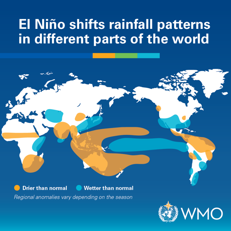
Climate scientists and weather experts are closely monitoring conditions in the Pacific Ocean amid growing indications that an El Niño weather pattern could develop later this year, potentially influencing weather conditions across several parts of the world, including southern Africa.
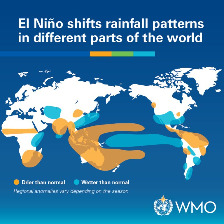
While forecasts remain subject to change, meteorological agencies and climate monitoring centres have noted that ocean and atmospheric conditions are being watched carefully for signs of a transition towards El Niño. Such developments are important for South Africa and neighbouring countries because El Niño events have historically been associated with below-average rainfall, higher temperatures and increased drought risk across parts of the summer rainfall region.
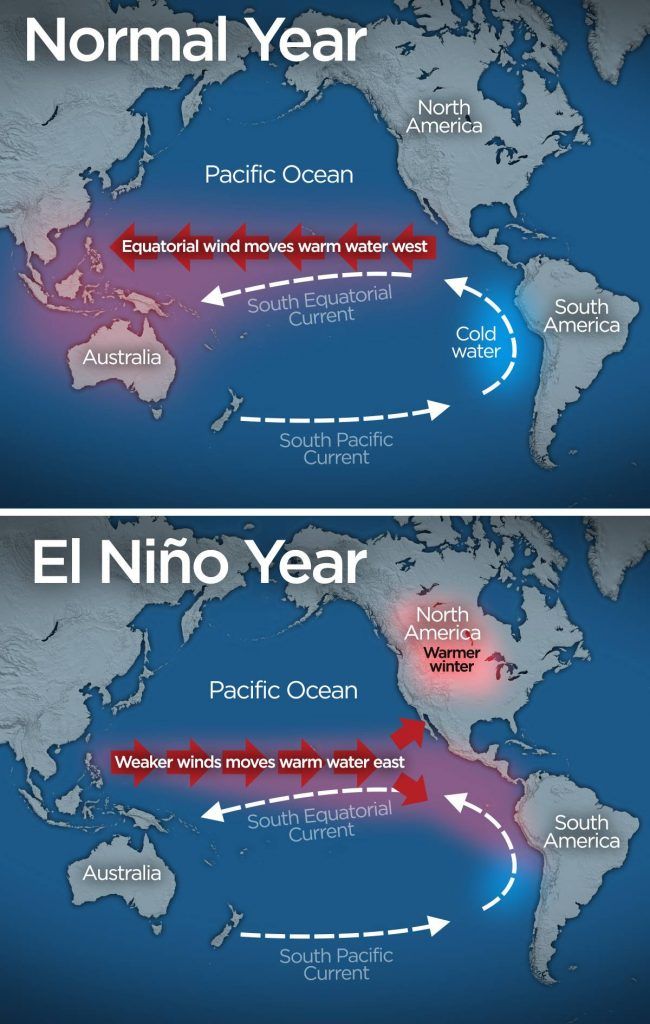
El Niño is a naturally occurring climate phenomenon that develops when sea surface temperatures in the central and eastern equatorial Pacific Ocean become warmer than normal. Although the warming occurs thousands of kilometres away from southern Africa, it can alter global weather patterns and influence rainfall and temperature trends in many regions.
Historically, strong El Niño events have been linked to significant weather disruptions in southern Africa. During past El Niño periods, some regions experienced reduced rainfall, prolonged dry spells, pressure on water resources, lower dam inflows and increased stress on agricultural production. Farmers, water managers and government agencies therefore closely monitor seasonal climate outlooks whenever El Niño conditions begin to emerge.
Climate experts caution that it is still too early to determine the exact strength, duration or impacts of any potential El Niño event. Seasonal forecasting remains complex, and several factors can influence how weather patterns eventually develop over southern Africa. Not every El Niño produces the same outcomes, and local weather conditions can vary significantly between provinces and regions.
The South African Weather Service (SAWS), together with international climate agencies such as the World Meteorological Organization (WMO) and other forecasting centres, continues to assess the latest ocean and atmospheric data. Updated seasonal outlooks are expected in the coming months as scientists gain greater confidence in long-range forecasting models.
Agricultural organisations are already paying close attention to developments because rainfall during the summer planting season is critical for crops such as maize, sunflower, soybeans and other agricultural products that contribute significantly to South Africa’s food security and economy.
Water authorities are also expected to monitor dam levels and rainfall forecasts closely, particularly in areas that have experienced drought conditions in the past. Municipalities and disaster management agencies may begin reviewing preparedness plans should forecasts indicate an increased risk of prolonged dry conditions.
Experts emphasise that there is currently no reason for public alarm. Instead, they encourage communities, farmers, businesses and policymakers to remain informed through official weather and climate updates as the situation develops.
Over the coming months, forecasters will be looking for stronger signals that could confirm whether El Niño conditions will fully develop and what the likely implications could be for South Africa’s upcoming summer rainfall season.
As climate variability continues to influence weather patterns worldwide, accurate forecasting and early preparedness remain critical tools for reducing the impact of potential droughts, heatwaves and other weather-related challenges.