South Africa | Weather
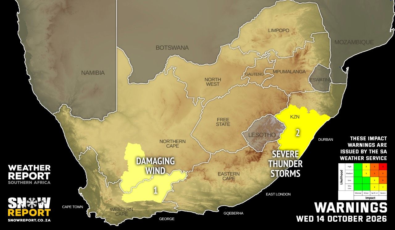
Residents across South Africa have been urged to remain alert as the South African Weather Service forecasts severe thunderstorms, heavy downpours, damaging winds and hail in KwaZulu-Natal on Wednesday, 14 October 2026.
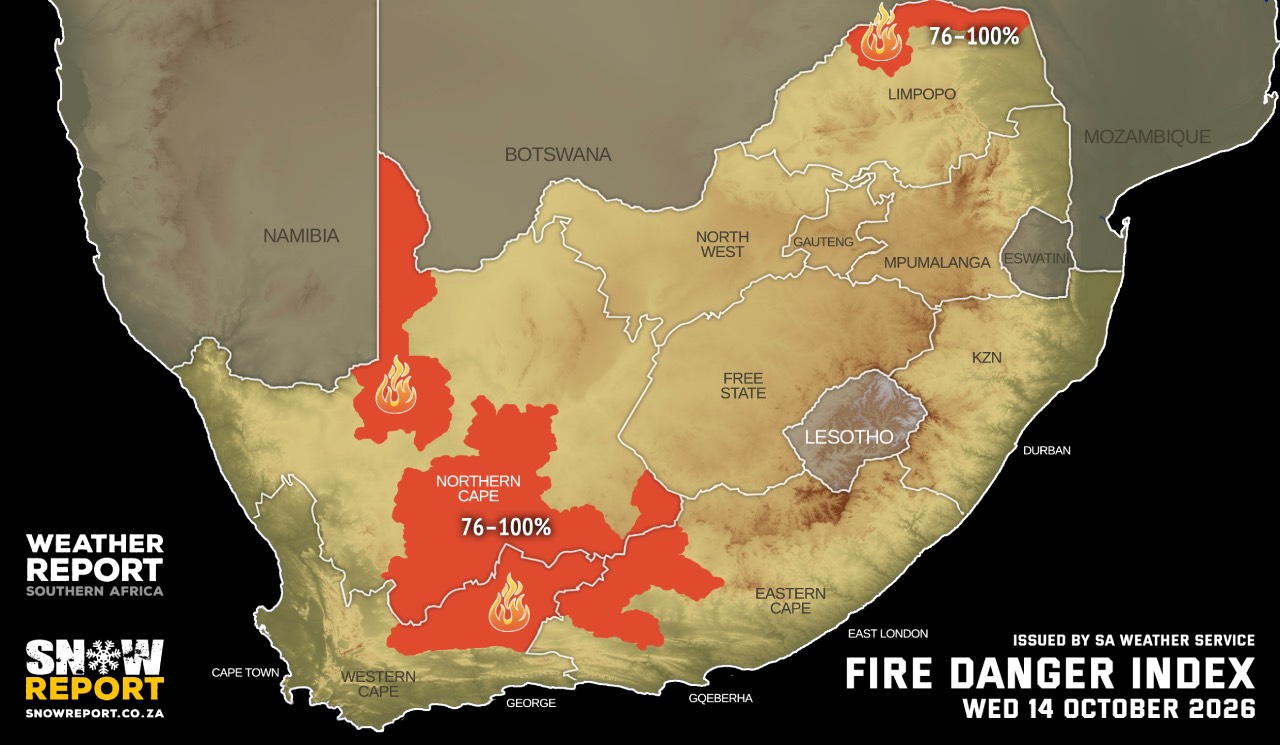
Parts of the Northern Cape and Western Cape face a damaging-wind warning, while extremely high fire danger conditions are expected in four provinces.
Hot conditions are also forecast in several parts of the country.
The latest forecast highlights several weather-related risks that could affect motorists, communities, infrastructure and people working outdoors. While most provinces are expected to experience partly cloudy conditions, isolated to scattered showers and thunderstorms are possible in several inland and eastern regions.
The public is advised to monitor official weather updates as conditions can change.
SAWS issues Level 2 severe thunderstorm warning for KwaZulu-Natal.
The South African Weather Service (SAWS) has issued a Level 2 impact-based warning for severe thunderstorms over most of KwaZulu-Natal, excluding the northern parts of the province.
The warning covers thunderstorms accompanied by heavy downpours, damaging winds, hail and lightning. These conditions could result in localised flooding and damage to infrastructure and settlements.Heavy rainfall over a short period can overwhelm drainage systems, flood low-lying areas and create dangerous conditions on roads. Strong winds and hail may also damage property, vehicles, crops and temporary structures.
Motorists travelling through affected areas should exercise caution, particularly where visibility deteriorates or water accumulates on road surfaces. Drivers should never attempt to cross a flooded road if the depth or strength of the water flow is uncertain.
The forecast indicates that KwaZulu-Natal will generally experience partly cloudy and warm to hot conditions.
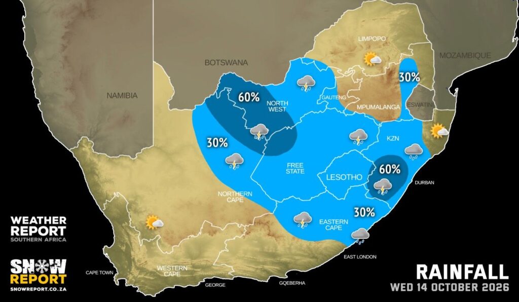
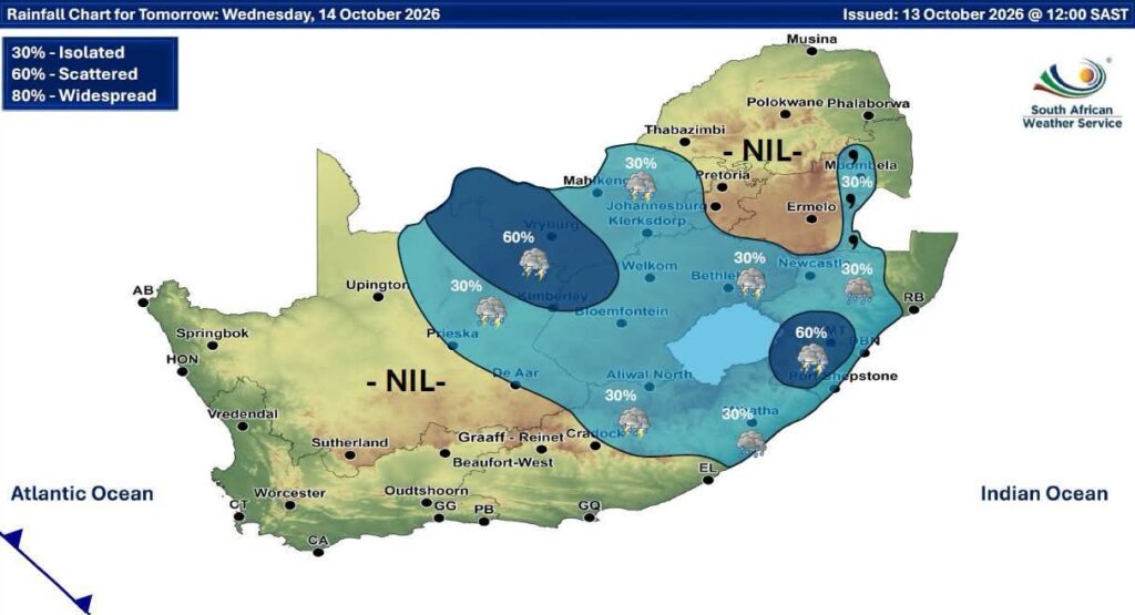
Morning fog is expected over the extreme western interior, while scattered showers and thundershowers are forecast in the south-west. Elsewhere, isolated showers and thunderstorms are expected, except in the north-east.
Coastal winds are forecast to be light to moderate from the southerly to south-westerly direction before becoming light to moderate north-easterly.
Heatwave conditions continue in north-western KwaZulu-Natal
Persistently high temperatures are expected to continue in parts of north-western KwaZulu-Natal until Thursday, 15 October.
The heatwave advisory means residents should take precautions against prolonged exposure to high temperatures, especially during the hottest part of the day.
People working outdoors, motorists travelling long distances and those involved in strenuous physical activities should take regular breaks, drink sufficient water and seek shade where possible.
Children, older people and people who are particularly vulnerable to heat should be monitored carefully. Symptoms of heat-related illness can include dizziness, headaches, nausea, weakness and confusion. Anyone experiencing severe symptoms should seek urgent medical assistance.
Forecast for other parts.
The forecast also indicates hot conditions in several other parts of the country, including sections of the North West, Free State, Limpopo and Northern Cape.
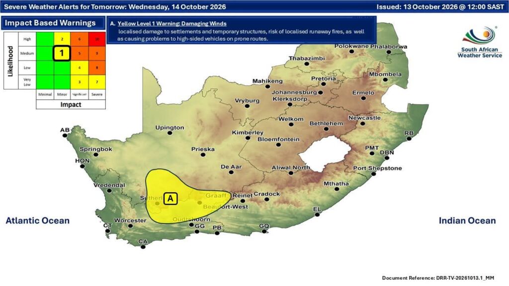
Level 1 damaging-wind warning for parts of the Northern and Western Cape
Level 1 warning has been issued for damaging interior winds affecting the Karoo Hoogland Local Municipality in the Northern Cape and the Central Karoo District Municipality in the Western Cape.
According to the warning, the winds could cause localised problems for high-sided vehicles travelling along exposed or vulnerable routes. Temporary structures could also sustain localised damage.
High-sided vehicles, including certain trucks and vehicles towing trailers, can be particularly vulnerable to strong crosswinds.
Motorists should reduce speed when necessary, maintain a safe following distance and take extra care on exposed roads.
Businesses, event organisers and residents using temporary structures should also assess whether their installations are adequately secured.
The broader regional forecast indicates that windy conditions are expected in parts of the Northern and Western Cape during the afternoon. Coastal areas could experience fresh to strong winds in certain locations.
Extremely high fire danger expected in four provinces.
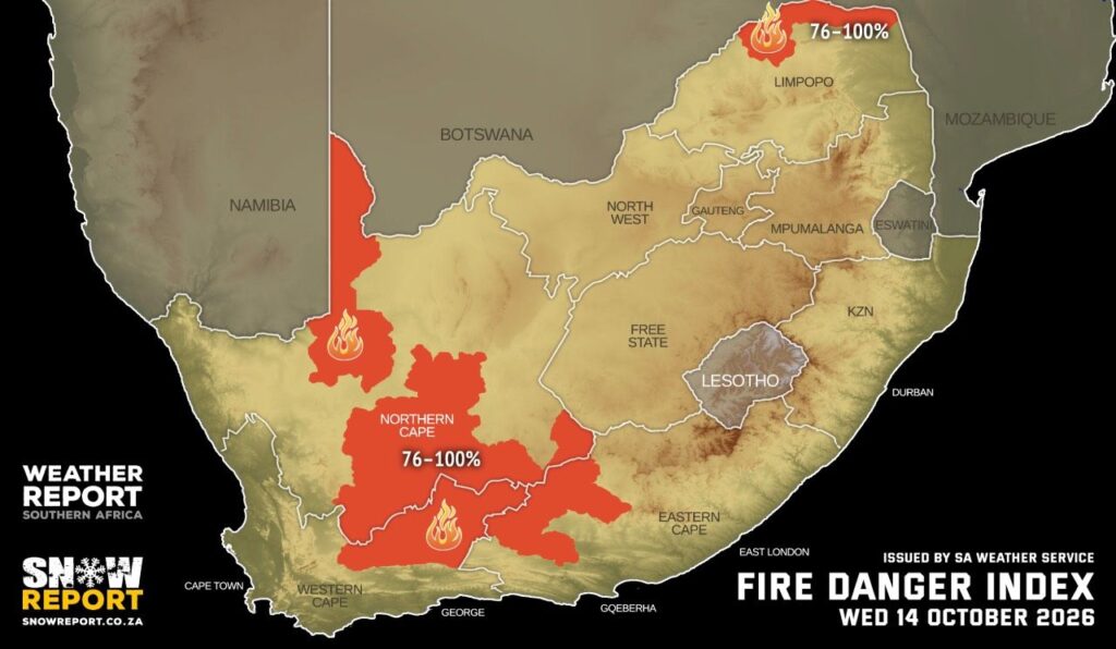
Windy conditions are forecast over southern parts of the province during the afternoon. Upington is expected to reach 34°C, while Kimberley is forecast to reach 31°C.
Western Cape
The province should experience fine conditions with high-level clouds in the west, while other areas will be partly cloudy and cool to warm. Morning fog is expected in places over the southern and central interior.
The Central and Little Karoo could experience windy conditions during the afternoon, with hot weather in places. Coastal winds will vary by location, with fresh to strong winds possible along sections of the coast.
Cape Town is forecast to reach 20°C, with George expected to reach 26°C.
Eastern Cape
The western half of the province is expected to experience morning fog in the south, with fog returning in the evening. Elsewhere, conditions should be fine and warm to hot before becoming partly cloudy and windy in the afternoon. Isolated thunderstorms are possible in the extreme eastern interior.
In the eastern half, morning fog is expected along parts of the coast and adjacent interior. Otherwise, partly cloudy and warm to hot conditions are forecast, with isolated showers and thundershowers.
Gqeberha is forecast to reach 26°C, while KuGompo City is expected to reach 28°C.
KwaZulu-Natal
KwaZulu-Natal faces the most significant severe-thunderstorm warning in Wednesday’s forecast. Morning fog is expected over the extreme western interior, followed by partly cloudy and warm to hot conditions.
Scattered showers and thundershowers are expected in the south-west, with isolated activity elsewhere except in the north-east.
The Level 2 warning highlights the potential for heavy downpours, damaging winds, hail and lightning over most of the province.
Durban is forecast to reach 27°C, Richards Bay 33°C and Pietermaritzburg 30°C.
The forecast is subject to change as weather systems develop. Residents are encouraged to consult the South African Weather Service for updated warnings and regional forecasts before travelling or undertaking outdoor activities.
Official information: https://www.weathersa.co.za/